time period of jugs and avatar

Whatever happened before Adam
kmaherali
Posts: 25714
Joined: Thu Mar 27, 2003 3:01 pm

Post by kmaherali »

eBook

Yugas, The - Keys to Understanding our Hidden Past, Emerging Energy Age and Enlightened Future (by Joseph Selbie & David Steinmetz)

Image

Free download at:

https://www.scribd.com/document/3999742 ... -Steinmetz

In my opinion it is the best book on implications of the knowledge of Yugas based on scientific evidence. I highly recommend it.
kmaherali
Posts: 25714
Joined: Thu Mar 27, 2003 3:01 pm

Post by kmaherali »

More evidence of the advanced ages of the past...

The world’s amazing lost cities recently rediscovered

Image

Lost cities found
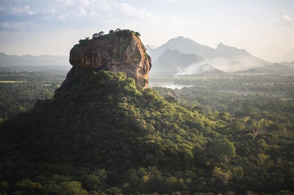
Founded, flourished and eventually forgotten – this has been the fate of many cities since ancient times. A few names have stayed alive in legend and literature while others disappeared completely – until a chance discovery brought these mysterious metropolises back from the dead. From Sigiriya, the amazing hill-top site in Sri Lanka, to the astonishing Pompeii in Italy, we look at some of the most fabulous cities lost and reborn.

Slide show at:

https://www.loveexploring.com/galleries ... red?page=1
Last edited by kmaherali on Wed Mar 03, 2021 4:48 am, edited 1 time in total.
kmaherali
Posts: 25714
Joined: Thu Mar 27, 2003 3:01 pm

Post by kmaherali »

Related book: Ten discoveries that rewrote history
Image

1. Ten Discoveries That Rewrote History Patrick Hunt
2. Publisher : Plume Release Date : 2007-09-25
3. The world’s greatest archaeological finds and what they tell us about lost civilizations Renowned archaeologist Patrick Hunt brings his top ten list of ancient archaeological discoveries to life in this concise and captivating book. The Rosetta Stone, Troy, Nineveh's Assyrian Library, King Tut’s Tomb, Machu Picchu, Pompeii, the Dead Sea Scrolls, Thera, Olduvai Gorge, and the Tomb of 10,000 Warriors—Hunt reveals the fascinating stories of these amazing discoveries and explains the ways in which they added to our knowledge of human history and permanently altered our worldview. Part travel guide to the wonders of the world and part primer on ancient world history, Ten Discoveries That Rewrote History captures the awe and excitement of finding a lost window into ancient civilization. Download Full PDF Here http://bit.ly/bedjopdf

Slide show and download at:

https://www.slideshare.net/Jennifer_per ... istory-pdf

http://ebooks24.club/download/books.php ... istory+pdf
Last edited by kmaherali on Wed Mar 03, 2021 4:53 am, edited 1 time in total.
kmaherali
Posts: 25714
Joined: Thu Mar 27, 2003 3:01 pm

Post by kmaherali »

The article below provides more evidence of sophisticated knowledge of ancient prehistoric times..

'Extremely rare’ Assyrian carvings discovered in Iraq
Image

In the eighth century B.C., Assyrian King Sargon II ruled over a wealthy and powerful empire that included much of today’s Middle East and inspired fear among its neighbors. Now a team of Italian and Iraqi Kurdish archaeologists working in northern Iraq have uncovered ten stone reliefs that adorned a sophisticated canal system dug into bedrock. The surprising find of such beautifully crafted carvings—typically found only in royal palaces—sheds light on the impressive public works supported by a leader better known for his military prowess.

“Assyrian rock reliefs are extremely rare monuments,” said Daniele Morandi Bonacossi, an archaeologist at Italy’s University of Udine, who co-led the recent expedition. With one exception, no such panels have been found in their original location since 1845. “And it is highly probable that more reliefs, and perhaps also monumental celebratory cuneiform inscriptions, are still buried under the soil debris that filled the canal.”

More...

https://www.nationalgeographic.com/hist ... vered-iraq
Last edited by kmaherali on Wed Mar 03, 2021 5:00 am, edited 1 time in total.
kmaherali
Posts: 25714
Joined: Thu Mar 27, 2003 3:01 pm

Post by kmaherali »

13 Mysteries That Could Be Solved in the Next Decade
Image


These mysteries are breaking the rules

As a general rule, the longer a mystery goes unsolved, the less likely it'll ever be cracked. However, all of these mysteries hold the promise of resolution in the near future date back years, if not centuries—some even date back to the beginning of time. Don't miss the strangest unsolved mystery from every state.

Slide show:

https://www.readersdigest.com.au/true-s ... ext-decade
Last edited by kmaherali on Wed Mar 03, 2021 5:04 am, edited 1 time in total.
kmaherali
Posts: 25714
Joined: Thu Mar 27, 2003 3:01 pm

Post by kmaherali »

The article below highlights the existence of city based civilizations at least during the bronze age if not earlier.

What Happened to the Original 1 Percent?

Modern cities can learn from the fate of the collapsed civilizations at Ugarit and Mycenae.


About 3,190 years ago, a merchant in Emar, a trading outpost in what is now northern Syria, sent a desperate letter to his boss, Urtenu, who lived in the rich metropolis of Ugarit, a city-state on the coast of Syria. “There is famine,” he wrote. “If you do not quickly arrive here, we ourselves will die of hunger.”

A long drought had left the hinterlands around Ugarit in a state of famine, wars were brewing, and there were likely plagues as well. Urtenu may not have realized it, but he was living through the last years of two wealthy cities, Ugarit and Mycenae, that dominated the eastern Mediterranean Sea during what historians call the Bronze Age, from roughly 3000 to 1200 B.C.E.

More than a thousand years before the Greeks invented democracy and the Romans undermined it with imperialism, these city-states of the Bronze Age laid the foundations for what is often called Western civilization. Homer recorded the myths of the Bronze Age in “The Iliad” and “The Odyssey,” and carved stone inscriptions of the pharaohs Hatshepsut and Thutmose III record the machinations of the Bronze Age elites. Although the rulers of the Bronze Age sometimes went to war, the true source of their power, like that of today’s biggest cities, was economic power secured through trade. The final decades of Ugarit and Mycenae tell us a lot about why cities fail — and who survives amid the ashes.

More..

https://www.nytimes.com/2020/05/11/opin ... ogin-email
kmaherali
Posts: 25714
Joined: Thu Mar 27, 2003 3:01 pm

Post by kmaherali »

These major cities were built on ancient ruins

These major cities were built on ancient ruins

Around the world, past civilizations lie just below the surface, with remains buried or partly visible today. Here are 20 major cities that were built on ancient ruins.

Slide show:

https://www.msn.com/en-ca/lifestyle/tra ... ut#image=1

Video:

https://www.youtube.com/watch?v=08hm8eyvYto
Last edited by kmaherali on Wed Mar 03, 2021 5:10 am, edited 1 time in total.
swamidada_2
Posts: 297
Joined: Mon Aug 19, 2019 8:18 pm

Post by swamidada_2 »

kmaherali wrote:These major cities were built on ancient ruins

These major cities were built on ancient ruins

Around the world, past civilizations lie just below the surface, with remains buried or partly visible today. Here are 20 major cities that were built on ancient ruins.

Slide show:

https://www.msn.com/en-ca/lifestyle/tra ... ut#image=1
Let me add two more...

Ruins dating from the Early Harappan period around 2900 BCE have also been discovered in the Taxila area, though the area was eventually abandoned after the collapse of the Indus Valley Civilization. The first major settlement at Taxila was established around 1000 BCE.


It was one of the largest cities of the ancient Indus Valley Civilization, also known as the Harappan Civilization, which developed around 3,000 BCE from the prehistoric Indus culture. ... Mohenjo-daro was the most advanced city of its time, with remarkably sophisticated civil engineering and urban planning.
kmaherali
Posts: 25714
Joined: Thu Mar 27, 2003 3:01 pm

Post by kmaherali »

More evidence unfolding about the advanced nature of prehistoric people...

Neolithic Site Near Stonehenge Yields an ‘Astonishing Discovery’

The finding of a circle of trenches at a nearby ancient village also makes the site the largest prehistoric structure in Britain and possibly in Europe, one archaeologist said.


Watch video at:

https://www.nytimes.com/2020/06/22/worl ... 778d3e6de3

LONDON — A new archaeological discovery at the site of an ancient village near Stonehenge promises to offer significant clues about life more than 4,500 years ago in the Neolithic period, and could even “write a whole new chapter in the story” of the celebrated structure’s landscape, experts say.

The find also makes the site the largest prehistoric structure in Britain and possibly in Europe, according to Vincent Gaffney, of the University of Bradford, an archaeologist involved in the analysis.

“It has completely transformed how we understand this landscape — there is no doubt about it,” he said.

Stonehenge, a UNESCO World Heritage site in the English countryside, has long drawn visitors to admire its looming stone slabs, even as its origins and purpose are still being explored.

The study, published online on Sunday, outlines the discovery of a large circle of shafts surrounding the ancient village — known as the Durrington Walls henge monument — about two miles from Stonehenge. The trenches, each of which is around 30 feet wide and 15 feet deep, are thought to have been part of a ritual boundary area between the two sites.

Uncovered through remote sensing technology and ground sampling, the discovery could amount to one of the most significant finds ever made at the site, archaeologists and experts said.

More and video:

https://www.nytimes.com/2020/06/22/worl ... 778d3e6de3
kmaherali
Posts: 25714
Joined: Thu Mar 27, 2003 3:01 pm

Post by kmaherali »

The oldest cities in the world

Many of the earliest cities in the world are still inhabited, serving as living records of humanity’s first forays into civilization. Archaeologists dispute exact timelines and what counts as a city proper, but there is no doubt the first urban centres enshrine the development of agriculture, trade, and the many great empires that rose and fell over the millennia. Here is a sampling of some of the oldest cities in the world still living today.

Slide show at:

https://www.msn.com/en-ca/lifestyle/tra ... ut#image=1
kmaherali
Posts: 25714
Joined: Thu Mar 27, 2003 3:01 pm

Post by kmaherali »

7 bizarre ancient cultures that history forgot

Long-Lost Cultures

The ancient Egyptians had their pyramids, the Greeks, their sculptures and temples. And everybody knows about the Maya and their famous calendar.

But other ancient peoples get short shrift in world history. Here are a handful of long-lost cultures that don't get the name recognition they deserve.

The Silla

The Silla Kingdom was one of the longest-standing royal dynasties ever. It ruled most of the Korean Peninsula between 57 B.C. and A.D. 935, but left few burials behind for archaeologists to study.

One recent Silla discovery gave researchers a little insight, however. The intact bones of a woman who lived to be in her late 30s was found in 2013 near the historic capital of the Silla (Gyeongju). An analysis of the woman's bones revealed that she was likely a vegetarian who ate a diet heavy in rice, potatoes or wheat. She also had an elongated skull.

Silla was founded by the monarch Bak Hyeokgeose. Legend held that he was hatched from a mysterious egg in the forest and married a queen born from the ribs of a dragon. Over time, the Silla culture developed into a centralized, hierarchical society with a wealthy aristocratic class. Though human remains from the Silla people are rare, archaeologists have unearthed a variety of luxurious goods made by this culture, from a gold-and-garnet dagger to a cast-iron Buddha to jade jewelry, among other examples held at the Gyeongju National Museum in South Korea. [See Images of the Long-Headed Woman's Facial Reconstruction]

The Indus

The Indus is the largest-known ancient urban culture, with the people's land stretching from the Indus River in modern-day Pakistan to the Arabian Sea and the Ganges in India. The Indus civilization persisted for thousands of years, emerging around 3300 B.C. and declining by about 1600 B.C.

The Indus, also known as the Harappans, developed sewage and drainage systems for their cities, built impressive walls and granaries, and produced artifacts like pottery and glazed beads. They even had dental care: Scientists found 11 drilled molars from adults who lived between 7,500 to 9,000 years ago in the Indus Valley, according to a study published in 2006 in the journal Nature. A 2012 study suggested that climatic change weakened monsoonal rains and dried up much of the Harappan territory, forcing the civilization to gradually disband and migrate to wetter climes.

The Sanxingdui

The Sanxingdui were a Bronze Age culture that thrived in what is now China's Sichuan Province. A farmer first discovered artifacts from the Sanxingdui in 1929; excavations in the area in 1986 revealed complex jade carvings and bronze sculptures 8 feet (2.4 meters) tall.

But who were the Sanxingdui? Despite the evidence of the culture's artistic abilities, no one really knows. They were prolific makers of painted bronze-and-gold-foil masks that some archaeologists believe may have represented gods or ancestors, according to the Sanxingdui Museum in China. The Sanxingdui site shows evidence of abandonment about 2,800 or 3,000 years ago, and another ancient city, Jinsha, discovered nearby, shows evidence that maybe the Sanxingdui moved there. In 2014, researchers at the annual meeting of the American Geophysical Union argued that at around this time, a major earthquake and landslide redirected the Minjiang River, which would have cut Sanxingdui off from water and forced a relocation.

The Nok

The mysterious and little-known Nok culture lasted from around 1000 B.C. to A.D. 300 in what is today northern Nigeria. Evidence of the Nok was discovered by chance during a tin-mining operation in 1943, according to the Metropolitan Museum of Art in New York. Miners uncovered a terra-cotta head, hinting at a rich sculptural tradition. Since then, other elaborate terra-cotta sculptures have emerged, including depictions of people wearing elaborate jewelry and carrying batons and flails — symbols of authority also seen in ancient Egyptian art, according to the Minneapolis Institute of Art. Other sculptures show people with diseases such as elephantiasis, the Met said.

Contributing to the mystery surrounding the Nok, the artifacts have often been removed from their context without archaeological analysis. In 2012, the United States returned a cache of Nok figurines to Nigeria after they were stolen from Nigeria's national museum and smuggled into the U.S.

The Etruscans

The Etruscans had a thriving society in northern Italy from about 700 B.C. to about 500 B.C., when they began to be absorbed by the Roman Republic. They developed a unique written language and left behind luxurious family tombs, including one belonging to a prince that was first excavated in 2013.

Etruscan society was a theocracy, and their artifacts suggest that religious ritual was a part of daily life. The oldest depiction of childbirth in Western art — a goddess squatting to give birth — was found at the Etruscan sanctuary of Poggio Colla. At the same site, archaeologists found a 4-foot by 2-foot (1.2 by 0.6 meters) sandstone slab containing rare engravings in the Etruscanlanguage. Few examples of written Etruscan survive. Another Etruscan site, Poggio Civitate, was a square complex surrounding a courtyard. It was the largest building in the Mediterranean at its time, said archaeologists who have excavated more than 25,000 artifacts from the site.

The Land of Punt

Some cultures are known mostly through the records of other cultures. That's the case with the mysterious land of Punt, a kingdom somewhere in Africa that traded with the ancient Egyptians. The two kingdoms were exchanging goods from at least the 26th century B.C., during the reign of the pharaoh Khufu (the builder of the Great Pyramid of Giza).

Strangely, no one really knows where Punt was located. The Egyptians left plenty of descriptions of the goods they got from Punt (gold, ebony, myrrh) and the seafaring expeditions they sent to the lost kingdom. However, the Egyptians are frustratingly mum on where all these voyages were headed. Scholars have suggested that Punt may have been in Arabia, or on the Horn of Africa, or maybe down the Nile River at the border of modern-day South Sudan and Ethiopia.

The Bell-Beaker Culture

People of the Bell-Beaker culture created pottery vessels shaped like inverted bells.

You know a culture is obscure when archaeologists name it based on its artifacts alone. The Bell-Beaker culture made pottery vessels shaped like upside-down bells. The makers of these distinctive drinking cups lived across Europe between about 2800 B.C. and 1800 B.C. They also left behind copper artifacts and graves, including a cemetery of 154 graves located in the modern-day Czech Republic.

The Bell-Beakers were also responsible for some of the construction at Stonehenge, researchers have found: These people likely arranged the site's small bluestones, which originated in Wales.

https://www.livescience.com/55430-bizar ... tures.html
kmaherali
Posts: 25714
Joined: Thu Mar 27, 2003 3:01 pm

Post by kmaherali »

The article below indicates the advanced state of organization and governance of prehistoric societies.

She Was Buried With a Silver Crown. Was She the One Who Held Power?

A tomb unearthed in Spain has prompted archaeologists to reconsider assumptions about women’s power in Bronze Age European societies.


Excerpt:

Like their contemporaries — such as the Minoans of Crete, the Wessex of Britain and the Unetice of Central Europe — the Argarics had the hallmarks of a state society, with a ruling bureaucracy, geopolitical boundaries, complex settlement systems and urban centers with monumental structures. They had divisions of labor and class distinctions that persisted after death, based on the wide disparity of grave goods discovered at archaeological sites.

Image
La Almoloya in 2015.Credit...Arqueoecologia Social Mediterrània Research Group, Universitat Autònoma de Barcelona

More...

https://www.nytimes.com/2021/03/11/scie ... 778d3e6de3
KayBur
Posts: 11
Joined: Thu May 27, 2021 12:41 am

Post by KayBur »

kmaherali wrote:The article below indicates the advanced state of organization and governance of prehistoric societies.

She Was Buried With a Silver Crown. Was She the One Who Held Power?

A tomb unearthed in Spain has prompted archaeologists to reconsider assumptions about women’s power in Bronze Age European societies.


Excerpt:

Like their contemporaries — such as the Minoans of Crete, the Wessex of Britain and the Unetice of Central Europe — the Argarics had the hallmarks of a state society, with a ruling bureaucracy, geopolitical boundaries, complex settlement systems and urban centers with monumental structures. They had divisions of labor and class distinctions that persisted after death, based on the wide disparity of grave goods discovered at archaeological sites.

Image
La Almoloya in 2015.Credit...Arqueoecologia Social Mediterrània Research Group, Universitat Autònoma de Barcelona

More...

https://www.nytimes.com/2021/03/11/scie ... 778d3e6de3
An interesting find. The main thing is to exclude the possibility of juggling facts and distorting the interpretation of the finds. Unfortunately, history and everything connected with it is a very unreliable thing, its presentation depends on who fell into the hands of the facts.
kmaherali
Posts: 25714
Joined: Thu Mar 27, 2003 3:01 pm

Post by kmaherali »

KayBur wrote: An interesting find. The main thing is to exclude the possibility of juggling facts and distorting the interpretation of the finds. Unfortunately, history and everything connected with it is a very unreliable thing, its presentation depends on who fell into the hands of the facts.
History is always subject to interpretation. However you cannot deny physical evidence as found and presented.
kmaherali
Posts: 25714
Joined: Thu Mar 27, 2003 3:01 pm

Ancient technology that was centuries ahead of its time

Post by kmaherali »

These astounding inventions show that civilizations of the past were a lot more advanced than we might have thought.

KEY TAKEAWAYS

Archaeologists repeatedly stumble upon artifacts that seem way too advanced for the times from which they originate. The ancient Greeks, for instance, developed a clock capable of calculating and tracking planetary motions and solar eclipses among other things. These forward-thinking inventions are often called "ahead of their time." In reality, they are reflections of the ingenuity of their respective civilizations.

We like to think of technological innovation as a gradual, steady, and fairly linear process. However, this is not necessarily the case. Archaeological excavations throughout the world reveal that, once in a while, ancient civilizations developed inventions that were decades if not centuries ahead of their time.

It is sometimes said that these inventions rival or outmatch modern science. This, too, is a misconception. While many ancient super technologies — from Roman concrete to Damascus steel — were once lost, they have since been recreated by present-day researchers. Usually, any difficulty in recreating them stems from the lack of original instruction rather than an inability to comprehend the invention itself.

Equally erroneous is the notion that ancient civilizations stumbled upon these technologies by accident, or that they were designed by idiosyncratic geniuses who were not representative of their day and age. Although many inventors mentioned in this article were indeed considered geniuses, they cannot and should not be separated from their surroundings. Their work is not anachronistic, but a testament to the ingenuity and scientific potential of their respective civilizations.

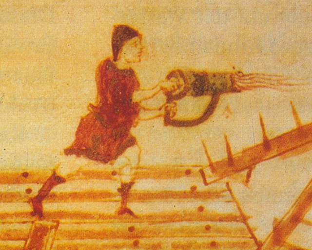
Greek fire: flames that don’t go out

Image
Depiction of a hand-siphon or portable flame-thrower containing Greek fire from the Codex Vaticanus Graecus. (Credit: Wikipedia)
When the Muslim fleet of the Umayyad Caliphate attempted to lay siege to the Byzantine city of Constantinople in 674, their ships were doused in flames. At first, the Muslims were not alarmed; fire was often used in naval warfare and could be put out easily with cloth, dirt, or water. This, however, was no ordinary fire. Once ignited, it could not be extinguished, and after the entire fleet had burned down, even the sea itself was set ablaze.

The Umayyad Caliphate met its doom at the hands of a new military invention known as Greek fire, Roman fire, liquid fire, or sea fire, among many other names. No recipe survives, but historians speculate it might have involved petroleum, sulfur, or gunpowder. Of the three, petroleum seems the likeliest candidate, as gunpowder didn’t become readily available in Asia Minor until the 14th century, and sulfur lacked the destructive power described by Arab observers.

However, what makes Greek fire so impressive is not the chemistry of the fire itself but the design of the pressure pump the Byzantines used to launch it in the direction of their enemies. As the British historian John Haldon discusses in an essay titled “‘Greek Fire’ Revisited,” researchers struggle to recreate an historically accurate pump that could have propelled its content far enough to be of any use during naval battles, where enemy ships may be dozens or even hundreds of meters removed from one another.

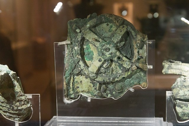
Antikythera mechanism: a cosmic clock before Copernicus

Image
Remnants of the mechanism of Antikythera at the National Archaeological Museum of Athens. (Credit: Zde / Wikipedia)

The Antikythera mechanism was found off the coast of Antikythera, a small Greek island located between Kythera and Crete. Its discovery occurred in 1901, when divers in search of sea sponges stumbled upon a deposit of sunken wreckage from classical antiquity. The titular contraption was incomplete and in poor condition, but seemed to have consisted of some 37 bronze gears stored inside a wooden box.

Scholars initially speculated that the Antikythera mechanism, which was found to be over 2,200 years old, had functioned as an ancient computer. This hypothesis was written off as being too improbable, only to be reaffirmed by more detailed studies from the 1970s. The current consensus holds the mechanism was an orrery: a model of the solar system that calculates and tracks celestial time.

CT scans reveal the contraption’s mindboggling complexity. A 2021 attempt at replicating the Antikythera mechanism referred to it as “a creation of genius — combining cycles from Babylonian astronomy, mathematics from Plato’s Academy, and ancient Greek astronomical theories.” It could calculate the ecliptic longitudes of the moon and sun, the phases of the moon, the synodic phases of the planets, the excluded days of the Metonic Calendar, and the Olympiad cycle, among a myriad of other things.

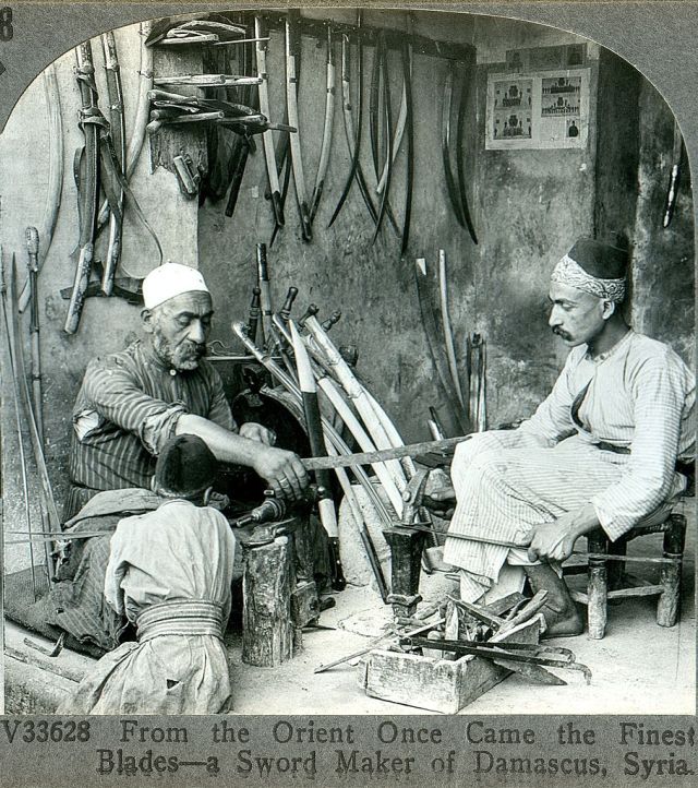
Damascus steel: swords that will not dull

Image
Damascus steel was renowned for its flowing or watered pattern. (Credit: Wikipedia)

Damascus steel swords originated in the Middle East during the 9th century and were renowned for their appearance as well as their durability, being multiple times stronger and sharper than the Western swords used during the Crusades. Their name, derived from the Arabic word for “water,” references not only the Syrian city from which they hailed but also the flowing pattern that adorns their surface. This pattern was created during a unique forging process where small ingots of wootz steel sourced from India, Sri Lanka, or Iran were melted with charcoal and cooled at an incredibly slow rate.

The demand for Damascus steel remained high for centuries, but gradually diminished as swords were replaced with firearms in armed conflicts; by 1850, the secrets of its production process appeared lost.


Interest in the swords was revitalized by C.S. Smith, a metallurgist who worked on the Manhattan Project. Unfortunately, Damascus steel can never be recreated authentically as wootz steel is no longer available. Since the 1960s, however, researchers have tried to develop new forging techniques that achieve similar results. This development is still ongoing; one study from 2018 claims adding small levels of carbide-forming elements like Vanadium (V) is the way to go.

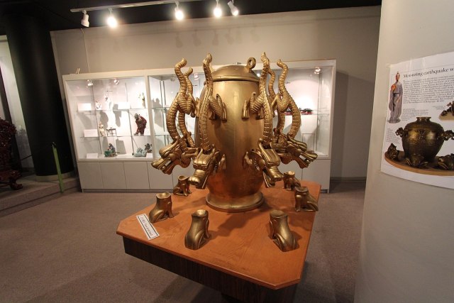
The Houfeng Didong Yi: the world’s first seismoscope

Image
A replica of the Houfeng Didong Yi. (Credit: The Chinese Museum Calgary Alberta / Wikipedia)

Created almost 2000 years ago, the Houfeng Didong Yi holds the honor of being the world’s first seismoscope. Its place of origin was China, a country that has been plagued by earthquakes for as long as its inhabitants can remember. Its creator was Zhang Heng, a distinguished astronomer, cartographer, mathematician, poet, painter, and inventor who lived under the Han Dynasty from 78 to 139 AD.

The design of the Houfeng Didong Yi is as functional as it is aesthetically pleasing. The mechanism consists of a large, decorated copper pot. The pot was fitted with eight tubed projections that were shaped to look like dragon heads. Below each dragon head was placed a copper toad with a large, gaping mouth.

“Zhang’s seismoscope,” one 2009 study from Taiwan explains, “is respected as a milestone invention since it can indicate not only the occurrence of an earthquake but also the direction to its source.” While primary sources are unclear as to how the seismoscope actually worked, researchers suggest that vibrations caused a pendulum inside the pot to swing, causing a small ball to release through a dragon head and into the mouth of its corresponding toad, indicating the direction of an earthquake.

Roman concrete: cement that does not crack

Image
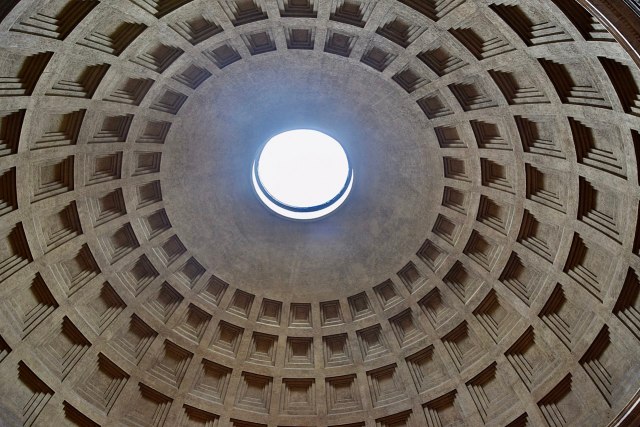
Roman concrete was used to create the unreinforced dome of the Pantheon. (Credit: Ank Kumar / Wikipedia)

Many architectural projects of ancient Rome would not have been possible without Roman concrete. Also known as opus caementicium, Roman concrete was a hydraulic-setting cement mix consisting of volcanic ash and lime that, in the words of Pliny the Elder, bound rock fragments into “a single stone mass” and made them “impregnable to the waves and every day stronger.”

The earliest-known reference to Roman concrete dates to 25 BC and comes from a manuscript titled Ten Books on Architecture, written by the architect and engineer Vitruvius. Vitruvius recommends builders use volcanic ash from the city of Pozzuoli in Naples, called pozzolana or pulvis puteolanus in Latin. Pozzolana should be mixed with lime at a ratio of 3:1 or 2:1 if the construction is under water.

When Vitruvius wrote his Ten Books on Architecture, Roman concrete was still considered a novelty and used sparingly. This changed in 64 AD, when an urban fire destroyed two thirds of the imperial capital. As the survivors set out to rebuild, Nero’s building code called for stronger foundations. The switch to Roman concrete — which, true to Pliny’s words, does not crack — enabled the construction of architectural projects like the Pantheon, the world’s oldest and biggest unreinforced dome.

Baghdad battery: a rudimentary taser (for pain relief)

The Greeks and Romans used electric fish to treat headaches. (Credit: kora27 / Wikipedia)
Archaeologists use the term “Baghdad battery” to refer to a ceramic pot, copper tube, and iron rod that were found in Iraq near what was once the capital of both the Parthian and subsequent Sasanian Empire. They believe the three distinct objects once fitted together to create a single device. The purpose of this device, which seems to have been capable of generating electricity, remains unclear.

Wilhelm König, director of the Iraq Antiquities Department — the same organization whose employees first found the battery — originally theorized that it was used as a galvanic cell to electroplate objects. This theory, though widely accepted upon its initial publication, does not hold up as no electroplated objects from the same time period and region have been discovered so far.

In 1993, Paul Keyser from the University of Alberta in Edmonton formulated a different, less anachronistic and therefore more plausible hypothesis. The battery, he argued, functioned not as a galvanic cell but a local analgesic that could relieve pain through transmitting an electrical charge. In doing so, it would have replaced electric fish, which in Greco-Roman societies were sometimes used to treat headaches, gout, and other conditions.

Listen to podcast at:

https://bigthink.com/the-past/examples- ... echnology/
kmaherali
Posts: 25714
Joined: Thu Mar 27, 2003 3:01 pm

Ancient city in Iraq unearthed after extreme drought

Post by kmaherali »

The article provides evidence of advanced civilizations in pre-historic times....

The Bronze Age settlement, long engulfed by the Tigris River, emerged earlier this year, and researchers were able to excavate the ancient city before the Mosul Dam refilled.
Image
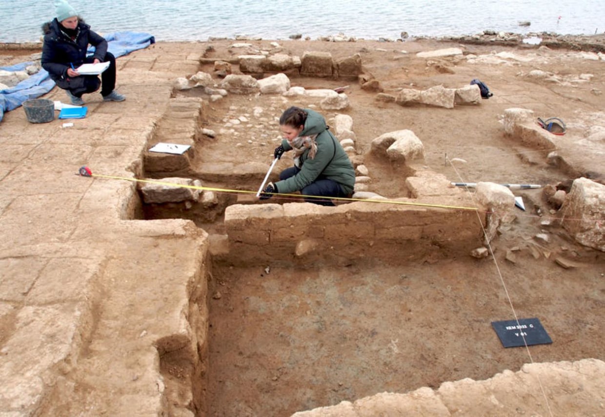
The excavated large buildings from the Mittani period are measured and archaeologically documented.

The ruins of a 3,400-year-old lost city — complete with a palace and a sprawling fort — have been unearthed in Iraq after extreme drought severely depleted water levels in the country's largest reservoir, archaeologists announced Monday.

The Bronze Age settlement, long engulfed by the Tigris River, emerged earlier this year in the Mosul Dam, and researchers raced to excavate the ancient city before the dam was refilled. The discovery is just the latest example of how drought conditions fueled by climate change are yielding unexpected finds: last month, in Nevada, falling water levels in Lake Mead turned up a pair of decades-old skeletal remains.

The Iraqi ancient city, located in the Kurdistan region at a site known as Kemune, was documented by a team of German and Kurdish archaeologists. The settlement was likely a key hub during the Mittani Empire, from 1550 to 1350 B.C., said Ivana Puljiz, a junior professor of Near Eastern archaeology at the University of Freiburg in Germany and a member of the research team.

"Since the city was located directly on the Tigris, it may have played an important role in connecting the core region of the Mittani Empire, which was located in present-day northeastern Syria, and the empire's eastern periphery," Puljiz said.

Image
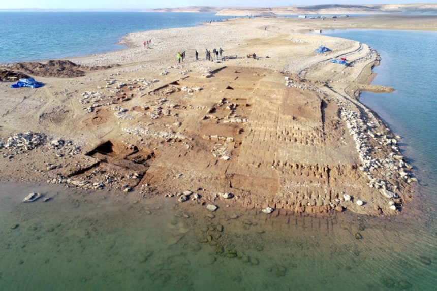
Aerial view of the excavations at Kemune with Bronze Age architecture partly submerged in the lake.Universities of Freiburg and Tübingen, KAO
Towers, a monumental palace and several other large buildings are among the surviving ruins of the fortified outpost. The archaeologists said the settlement is thought to be the ancient city of Zakhiku, once a buzzing political center in the region.

The researchers said the fortification walls — standing several meters tall in some places — are surprisingly well preserved despite being constructed of sun-dried mud bricks. The Bronze Age city was destroyed in an earthquake that struck the region sometime around 1350 B.C., according to the archaeologists. The natural disaster likely caused the upper parts of the walls to bury most of the surviving buildings, keeping them in relatively good condition over millennia, they added.

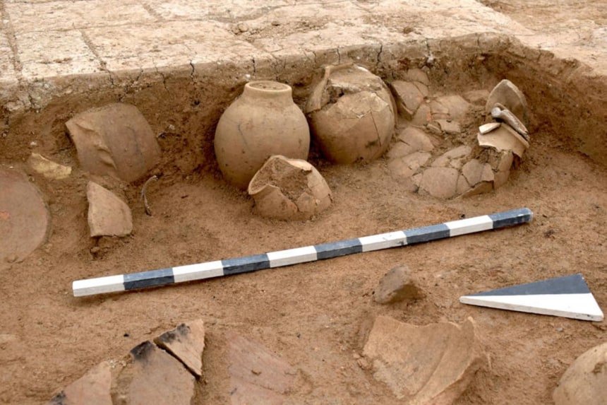
The dig at Kemune also uncovered five ceramic vessels that contained more than 100 tablets inscribed with cuneiform script. The artifacts, which the archaeologists said may be some form of ancient correspondence, date to the Middle Assyrian period, shortly after the fateful earthquake.


Image
Pottery vessels, in which cuneiform tablets were stored, are standing in the corner of a room from the Middle Assyrian period.Universities of Freiburg and Tübingen, KAO
"It is close to a miracle that cuneiform tablets made of unfired clay survived so many decades under water," Peter Pfälzner, director of the Department of Near Eastern Archaeology at the University of Tübingen in Germany and a member of the research team, said in a statement.

https://www.nbcnews.com/science/science ... -rcna31424
kmaherali
Posts: 25714
Joined: Thu Mar 27, 2003 3:01 pm

Iraq's answer to the pyramids

Post by kmaherali »

More on Iraq's ancient civilization...

Image

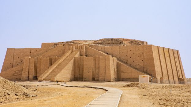
Egypt may have the Pyramids of Giza, but Iraq has the Ziggurat of Ur – an incredibly well-preserved engineering achievement that towers over the ruins of an important ancient city.

Around 4,000 years ago, this pale, hard-packed spit of Iraqi desert was the centre of civilisation. Today the ruins of the great city of Ur, once an administrative capital of Mesopotamia, now sit in a barren wasteland near Iraq's most notorious prison. In the shadow of the towering prison fences, Abo Ashraf, the self-proclaimed caretaker of the archaeological site, and a handful of tourists are the only signs of life for miles. At the end of a long wooden walkway, an impressive ziggurat is nearly all that remains of the ancient Sumerian metropolis.

To get here, I'd been packed into the backseat of a taxi hurtling through the desert for hours, until I began to see the city's famed monument looming in the distance: the Ziggurat of Ur, a 4,100-year-old massive, tiered shrine lined with giant staircases. A tall chain link fence barricading the entrance and a paved parking lot were the only hints of the modern world.

The very first ziggurats pre-date the Egyptian pyramids, and a few remains can still be found in modern-day Iraq and Iran. They are as imposing as their Egyptian counterparts and also served religious purposes, but they differed in a few ways: ziggurats had several terraced levels as opposed to the pyramids' flat walls, they didn't have interior chambers and they had temples at the top rather than tombs inside.

"A ziggurat is a sacred building, essentially a temple on a platform with a staircase," said Maddalena Rumor, an Ancient Near-East specialist at Case Western Reserve University in the US. "The earliest temples show simple constructions of one-room shrines on a slight platform. Over time, temples and platforms were repeatedly reconstructed and expanded, growing in complexity and size, reaching their most perfect shape in the multi-level Ziggurat [of Ur]."

The Ziggurat of Ur was built a bit later (about 680 years after the first pyramids), but it is renowned because it is one of the best-preserved, and also because of its location in Ur, which holds a prominent place in history books. According to Rumor, Mesopotamia was the origin of artificial irrigation: the people of Ur cut canals and ditches to regulate the flow of water and irrigate land further from the Euphrates River banks. Ur is also believed to be the birthplace of biblical Abraham and, as Ashraf explained while he walked us through the ruined walls of the city, the home of the first code of law, the Code of Ur-Nammu, written around 2100 BCE – 400 years before Babylonia's better-known Code of Hammurabi.

Image
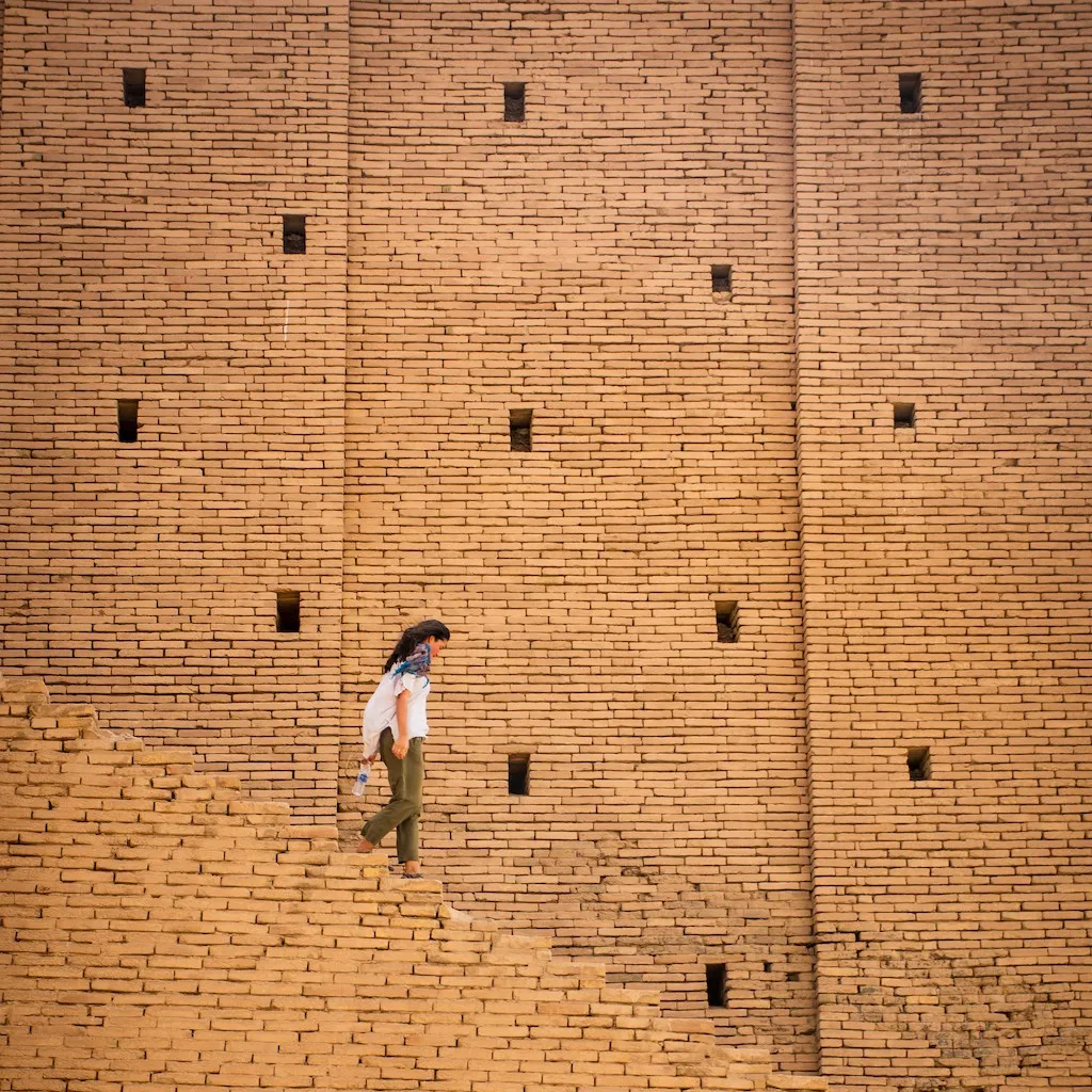
The Sumerians bored hundreds of square holes into the outer walls to allow the internal mud-brick core to stay dry (Credit: Geena Truman)

"In Mesopotamia, every city was believed to have been founded and built as the residence of a god/goddess… who acted as its protector and political authority," Rumor said. In Ur, that was Nanna the moon god – for whom the ziggurat was constructed as an earthly home and temple. "The cult of Nanna developed very early around the lower course of the Euphrates (at the centre of which was Ur) in connection with the herding of cows and the cycles of nature that increased the herd," she said.

The structure's lower tiers remain today, though the temple and upper terraces at the top have been lost. To figure out what they looked like, specialists have used all kinds of technology and ancient writings (from historians like Herodotus, as well as the Bible). In her 2016 paper, A Ziggurat and the Moon, Amelia Sparavigna, an archaeological imaging specialist with the Polytechnic University of Turin, wrote, "[Ziggurats] were pyramidal structures with a flat top, with a core made up of sun-baked bricks, covered by fired bricks. The facings were often glazed in different colours...".

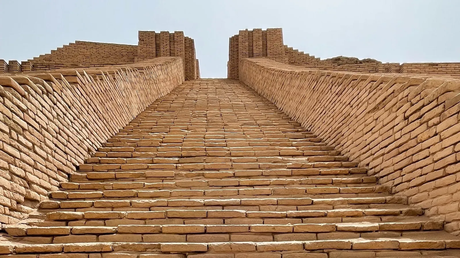
Based on remnants found at the site, it has been generally agreed that the Ziggurat of Ur held a cerulean temple sitting atop two massive mud-brick tiers. The base alone consisted of more than 720,000 meticulously stacked mud bricks, weighing up to 15kg each. Reflecting Sumerian knowledge of the lunar and solar cycles, each of the ziggurat's four corners pointed in a cardinal direction as exact as a compass, and a grand staircase to the upper levels was oriented toward the summer solstice sunrise.

I could see the remains of this great achievement as Ashraf led me and the other few tourists to the main staircase. He knows the site well: he moved here with his father 38 years ago to assist with archaeological digs, and his family home lies just steps from the entrance. Once I reached the summit, I could imagine the ancient kingdom sprawling out in every direction thousands of years ago.

Image
Each of the ziggurat's four corners pointed in a cardinal direction, and a grand staircase was oriented toward the summer solstice sunrise (Credit: Geena Truman)

King Ur-Nammu laid the ziggurat's first brick in 2100 BCE, and construction was later completed by his son King Shulgi, by which time the city was the flourishing capital of Mesopotamia. But by the 6th Century BCE, the ziggurat was in ruins thanks to the desert's extreme heat and harsh sand. King Nabonidus of Babylonia set to work restoring it around 550 BCE, but instead of re-creating the original three tiers, he built seven, aligning with other grandiose Babylonian structures of the time, such as the Etemenanki ziggurat, which some believe was the famed tower of Babel.

The bulk of the ziggurat remains intact today largely due to three ingenious innovations by the original Sumerian engineers.

First was ventilation. As with other ziggurats, this one was constructed with a core of mud bricks surrounded by an exterior of sun-baked bricks. And since that core retained moisture that could have led to the overall degradation of the structure, the Sumerians bored hundreds of square holes into the outer walls to allow for quick evaporation. Rumor explained that without this detail, "the mud-brick interiors could soften during heavy rains, and eventually bulge or collapse".

Second, the walls were built at a slight slant. This allowed water to flow down the ziggurat's sides, preventing pooling on the upper levels; the angle made the structure appear larger from a distance, intimidating the empire's enemies.

Lastly, the temple on top was built with fully baked mud bricks held together by bitumen. This naturally occurring tar staved off water seepage into the unbaked core.

Despite these achievements, by the 6th Century CE, the once-thriving metropolis had metaphorically and physically dried up. The Euphrates River had changed its course, leaving the city without water and therefore uninhabitable. Ur and the ziggurat were abandoned and subsequently buried beneath a mountain of sand by wind and time.

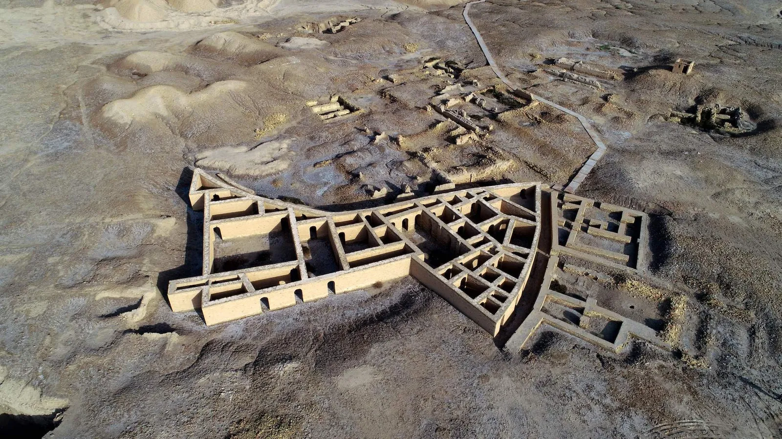
It wasn't until 1850 that the remains of the ziggurat were found again; later, in the 1920s, British archaeologist Sir Leonard Woolley led an in-depth excavation of the monument, uncovering what was left of the structure and digging up gold daggers, carved statues, delicate lyres and intricate headdresses from surrounding graves. But as Ashraf noted, "With only 30% of the site excavated, much more remains to be discovered."

Image
Ur is believed to be the birthplace of biblical Abraham and the home of the first code of law (Credit: Assad Niazi/Getty Images)

Even so, the ziggurat is important enough to have been used as a pawn in modern wartimes. During the Gulf War in 1991, Saddam Hussein parked two of his MiG fighter jets alongside it, in hopes that the historical site would keep the United States and other foreign nations from attacking his planes. Unfortunately, the ziggurat still suffered minor damage.

In 2021, Iraq opened its doors to an array of Western countries, and tourism has been emerging slowly (though many governments still advise against travel here). Janet Newenham, an Irish travel journalist and owner of Janet's Journeys, visited Iraq shortly after the visa-on-arrival programme launched. Since then, she has led several group tours to the region. "On our first trip in July 2021, we saw not one other tourist," she said. "By the time my April 2022 trip came around, we would often meet small groups of adventurous tourists… we never saw more than four or five other tourists at a time though.

Yet nearly every day, Ashraf braves the heat to help tourists understand the importance of the ziggurat. He said he taught himself English by "studying the dictionary" and when most of his foreign visitors were Japanese, he set to work learning snippets of Japanese as well.

As I carefully climbed the grand staircase leading to the flat upper floor, I could still see bits of bitumen between the broken bricks. I also spotted a small, inscribed brick that recognises Saddam Hussein for his partial reconstruction of the monument in 1980. The upper terraces and the colourful temple have long been destroyed and lost to time. But across the nearly flat expanse of desert, I could see small mounds scattered throughout the area waiting to be excavated, no doubt hiding a world of treasures yet to be discovered.

Ancient Engineering Marvels is a BBC Travel series that takes inspiration from unique architectural ideas or ingenious constructions built by past civilisations and cultures across the planet.

https://www.bbc.com/travel/article/2022 ... e-pyramids
kmaherali
Posts: 25714
Joined: Thu Mar 27, 2003 3:01 pm

With Drought, ‘Spanish Stonehenge’ Emerges Once Again

Post by kmaherali »

The Dolmen of Guadalperal, a Bronze Age stone monument newly exposed by plummeting water levels in Europe, is now imperiled by tourists.

Image
The Dolmen of Guadalperal, a megalithic archaeological site exposed by drought at the Valdecañas reservoir in western Spain.Credit...Pierre-Philippe Marcou/Agence France-Presse — Getty Images

Like the skeleton of an extinct sea monster, the Dolmen of Guadalperal has resurfaced from the depths of the Valdecañas reservoir in western Spain, where Europe’s persistent drought has caused water levels to plummet and submerged monuments to come to light. The remnants of this Bronze Age sepulcher, nicknamed the Spanish Stonehenge, are now fully exposed for only the fifth time since the area was deliberately flooded in 1963 as part of a rural development project.

Dolmens were single-chambered tombs that often combined religious ceremony with precise sun sightings. The one that just reappeared in Spain dates to the fourth or fifth millennium B.C., which makes it as much as 2,000 years older than its Celtic cousin on the Salisbury Plain in England.

What remains of the Guadalperal complex is a ring of quartzite, 117 feet in diameter, surrounding 144 jagged granite standing stones, many of which are no longer standing. The stones, or menhirs — some as tall as six feet — buttressed a massive capstone set in a tumulus, or a mound of earth and pebbles. Both the capstone and the tumulus were dismantled in 1925 during an excavation led by Hugo Obermaier, a Spanish-German anthropologist and prehistorian.

Primitiva Bueno Ramírez, an archaeologist at the University of Alcalá in Madrid who has studied this dolmen for three decades, sees the menhirs as frozen fragments of history. She called their reappearance “the past emerging from the waters.”

Angel Castaño, a philologist who lives near the artificial lake and serves as the president of a local cultural association, likens the megalith to a gigantic eye gazing into prehistoric Spain. “It helps you to remember that the place was, for millenniums, a strategic gateway connecting the south and the north of the Iberian Peninsula,” he said. “The dolmen overlooked one of the few spots where it was possible to cross the Tagus River, which divided the west half of Spain from the east. The place was hugely important until bridges were built a few centuries ago.”

An atmospheric high-pressure system driven by climate change has left parts of the Iberian Peninsula at their driest in 1,200 years, according to a modeling study published in July in the journal Nature Geoscience. Artificial lakes, which supply water to homes, farms and factories, dropped to 36 percent of capacity on average in early August, well below the 10-year average of 61 percent. (The water level in the Valdecañas reservoir currently hovers at 28 percent of capacity.)

Dozens of sunken landmarks — churches, cemeteries, bridges, roads, archaeological sites — have recently resurfaced during the prolonged dry spell, which made this July the hottest month in Spain since at least 1961. In February, the abandoned Galician village of Aceredo, swamped by a dam in 1992, became visible after the drought nearly emptied the Alto Lindoso reservoir. This summer, at the Buendia reservoir east of Madrid, receding waters exposed the ruins of a village and bathhouses, caked in dried mud. In the Catalan town of Sant Romà de Sau, which vanished from view in 1965 when the Sau dam was built, an 11th-century Lombard Romanesque church reappeared, still intact. Normally, only the church’s bell tower pierces the water’s surface.

Image
An elevated view of the ruins of a small village, caked in mud and missing roofs and strewn with debris, which line the edge of a reservoir that reflects the clouds in the sky. In the distance, a bridge crosses the reservoir and mountains line the horizon.
The former village of Aceredo, submerged in 1992 to make way for the Alto Lindoso reservoir.Credit...Carmelo Alen/Agence France-Presse — Getty Images

Image
What’s left of the La Isabela bathhouses, seen from above, in the drying Buendia reservoir.Credit...Susana Vera/Reuters

Image
A view from directly overhead shows the Guadalperal dolmen and the surrounding circles of stone and earth at the edge of the reservoir. A tiny boat sits at the edge of the shore.
The Guadalperal complex seen from above, showing the ring of quartzite, 117 feet in diameter, surrounding the 144 menhirs.Credit...Silvio Castellanos/Reuters

Image
The church of Sant Romà de Sau, which vanished in 1965 when the Sau reservoir was made.Credit...Josep Lago/Agence France-Presse — Getty Images

When Dr. Obermaier and his team unearthed the Dolmen of Guadalperal a century ago, the ruins squatted on a cliff high above the river. He had been encouraged to explore the hilltop by his sponsor, the Duke of Alba, who presided over the Royal Academy of History and was an early champion of archaeology in Spain. (Dr. Obermaier, an ordained priest, moonlighted as chaplain of the House of Alba.) Guadalperal was then the property of the duke’s brother, the Duke of Peñaranda de Duero.

The municipality of Peraleda de la Mata, where the dolmen is situated, has an embarrassment of Paleolithic riches. “The first evidence for agricultural practices and livestock breeding comes from an Early Neolithic site in the area that we excavated several years ago,” said Enrique Cerrillo Cuenca, a professor of prehistory at Complutense University of Madrid. “We know that communities around 5,200 B.C. were storing aliments, collecting acorns and harvesting cereals, among other activities.”

Dr. Obermaier’s survey of the local terrain pointed to the presence of a long barrow, an elongated stone monument to the dead. It wasn’t long before his team dug up the dolmen’s entryway, a portal so narrow that the structure could have been built by benevolent giants for a colony of hobbits. The chamber in which the dead presumably would have been interred, which today is a central, open oval 16 feet across, was entered through a corridor five feet wide and 69 feet long. “The builders obviously wanted it dark and mysterious, maybe to highlight the amazing light of the equinox when it entered,” Mr. Castaño said.

Among the items recovered during the dig were pots, arrows, bows, axes, flint knives, ceramics, pendants and a hole-puncher made of copper. The researchers discovered a Roman coin, but no human remains. The crew restored some of the fallen menhirs to their rightful places, reinforced the corridor with concrete and made sketches of any engravings they found.

Dr. Overmaier’s research on the site was never published during his lifetime. He became a citizen of Spain in 1924 and, at the start of the Spanish Civil War, went into exile in Switzerland, where he died in 1946. Fourteen years later, two German archaeologists, Georg and Vera Leisner, adapted his notes into a monograph.

Image
A ground-level view of one of the dolmen in the foreground, behind which a tourist wearing a backpack takes a photo. There are several other stones visible, blocking a setting sun.
Tourists visiting the Dolmen of Guadalperal, which can be reached on boats operated by a private firm, although archaeologists discourage visits to the site.Credit...Pierre-Philippe Marcou/Agence France-Presse — Getty Images

The publication coincided with a wide-ranging civil engineering scheme, undertaken by the Spanish dictator Francisco Franco, that involved the construction of hydroelectric dams. By 1963, the dolmen and vestiges of the Roman city Augustóbriga were buried at the bottom of the Valdecañas reservoir. In all, Dr. Bueno and her colleagues have identified 200 underwater Bronze Age and Copper Age sites.

Although an Augustóbriga aqueduct, paved roads and thermal baths were sacrificed to the dam, a second-century A.D. temple, known as Los Mármoles (the Marbles), was dismantled stone by stone and reassembled on higher ground four miles away. The 20th-century inhabitants of the settlement were relocated, too.

Since resurfacing in the summer of 2019, the Dolmen of Guadalperal has re-emerged every July, only to be swallowed by the lake again every September. Mr. Castaño and his organization, Raíces de Peraleda (the Roots of Peraleda), support a petition drive to have the government move the cracked and toppling megaliths to a new location on permanently dry land. “The combination of climate change and new electricity policies is very bad news for the preservation of the dolmen, since changes in the environment rapidly weaken the stones,” Mr. Castaño said.

The exposed monument is also imperiled by tourists, many wielding smartphones and selfie sticks, who reach the site on boats operated by a private firm. “Human presence on the site is very detrimental,” Dr. Bueno said. “In our last measurements we verified that the constant trampling of visitors from 2019 to 2021 caused a decrease in the sediments, due to their plasticity, which left the dolmen’s supports almost without a base.”

With so much unmonitored traffic at the monument, Mr. Castaño is concerned about the possible damage to the fingerlike menhir at the entrance to the burial vault. The slab is engraved with a vaguely anthropomorphic shape on one side and a squiggle on the other. Mr. Castaño believes that the squiggle depicts the contours of the Tagus before the dam was erected. A crook in the squiggle, he said, corresponds to a “strange bend” in old maps of the river. “If the curvy line does represent the ancient course of the Tagus, the menhir may be the oldest realistic map in the world,” he said.

Dr. Bueno demurred. “The hypothesis of a map is based on a pareidolia,” she said, meaning the tendency for perception to impose a meaningful interpretation on an ambiguous visual pattern. Dr. Bueno noted that the squiggle is geometric and similar to twisty markings found in megalithic art across Europe.

Her conclusion: It’s a snake.

https://www.nytimes.com/2022/09/09/scie ... pe=Article
kmaherali
Posts: 25714
Joined: Thu Mar 27, 2003 3:01 pm

Maharashtra: Ancient stone age tools found in India cave

Post by kmaherali »

More on advanced prehistoric civilizations....

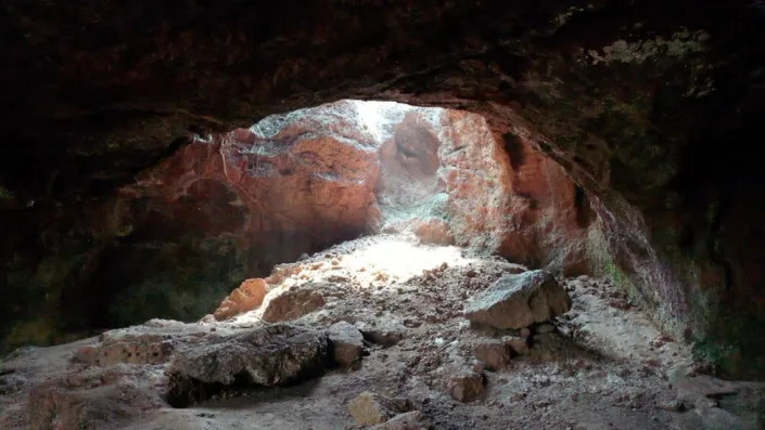
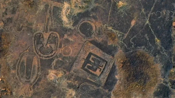
Over the years rock carvings of a previously unknown civilisation have been found in India's western state of Maharashtra. Now, a cave in the same region is promising to shed more light on the creators of these prehistoric artworks and their lives. The BBC Marathi's Mayuresh Konnur reports.

The cave, located around 10km (six miles) away from Koloshi village in the Konkan region of western Maharashtra, was discovered by a group of researchers last year. Excavations earlier this year revealed several stone tools in the cave that date back tens of thousands of years.

"Nowhere in the world can we find rock art of this kind," says Dr Tejas Garge, who heads Maharashtra's archaeology department. Archaeologists believe these artefacts can help us find out more about the way our ancestors lived.

Rock Carvings
Image
Two rounds of excavations were conducted in the cave

The cave, which is situated in a secluded forest in Sindhudurg, was discovered by researchers who were studying rock carvings in nearby areas. Excavation work was conducted in two rounds, during which archaeologists dug two trenches inside the cave. Several big and small stone tools dating back to the Mesolithic period - also called the middle stone age - have been found.

"The microliths, or the small stone tools, date back to around 10,000 years, whereas the larger tools could be around 20,000 years old," says Rutivij Apte, who has been researching the Konkan petroglyphs and was part of the excavation team.

Dr Parth Chauhan, an archaeologist, says chemical processes are used to analyse any residue that might be present on the edges of the artefacts. This can help determine what the object was used for.

"It will take a couple of months to find out the exact time period these stone tools belong to. But right now, we can say that these artefacts are between 10,000 to 48,000 years old."

Maharashtra's laterite-rich Konkan plateau where this cave was discovered is also a treasure trove of prehistoric art. In the past explorers have discovered rock carvings of animals, birds, human figures and geometrical designs hidden under layers of soil in several villages here.

So far, 1700 petroglyphs - or rock carvings - have been found at 132 locations in 76 villages in Sindhudurg and nearby Ratnagiri district.

Saili Palande Datar, a Pune-based art historian and writer, says these carvings offer great insights into the life and habits of prehistoric man.

She gives the example of an iconic rock carving of a human-figure found near Barsu village in Ratnagiri district.

Rock carvings
Image
Several petroglyphs - rock carvings - have been found in Maharashtra's Konkan region

The carving is embossed on a rock and seems to be of a male figure who is holding what appears to be tigers and other wild animals in both hands.

"There is an amazing sense of symmetry in this carving, which points to a high level of skill. The picture also depicts the relationship man shared with animals," Ms Datar says.

He says that seals of the Harappan civilisation - one of the oldest civilisations in human history that flourished in the Indian subcontinent - also depict the close relationship man shared with animals.

"The seals have images of large animals like tigers and buffaloes and of man hunting animals," she says.

Experts say that mysteries around these prehistoric rock carvings are far from being solved, but a Unesco tag - natural and cultural landmarks from around the world are singled out for their "outstanding universal value" to humanity - can help preserve them for generations.

Eight rock carving sites in the Konkan region are already a part of Unesco's tentative list of World Heritage sites, which is the first step towards getting the tag for any culturally-significant site.

https://www.yahoo.com/news/maharashtra- ... 22774.html
swamidada
Posts: 1615
Joined: Sun Aug 02, 2020 8:59 pm

Re: time period of jugs and avatar

Post by swamidada »

Miami Herald
An ancient Roman city is unearthed in Egypt. Take a look inside the city streets
Irene Wright
Wed, January 25, 2023 at 5:00 PM CST
Egyptian archaeologists working on the east bank of the Nile River have discovered what they believe to be a complete residential city from the Roman era, according to a Ministry of Tourism and Antiquities release.

The ruins were found in the city of Luxor in southern Egypt. The city was once the site of the pharaoh capital Thebes during the height of their power from the 16th to 11th centuries B.C., according to Britannica.

The ministry said the discovery was the oldest, and most important, residential city found so far in Luxor. The findings included residential buildings and bathroom towers, dated to the second and third centuries A.D.

Residential buildings and bathroom towers were dated to the second and third centuries A.D.

The archaeologists also found industrial and metal-working workshops and the things created in them. These include pots, water bottles, pottery, grinding tools and Roman coins, both copper and bronze.

Findings included pots, water bottles, grinding tools and Roman coins.

Director general of archaeology Fathi Yassin said in the release that they also found pigeon towers, once used to house birds. There were also pots that may have been used for pigeon nests, a practice that was likely started during the Roman era.

Excavation began on the site in September as part of a series of projects.

Mustafa Waziri, secretary general of the Supreme Council for Archaeology, said in the release that he was happy about the result of the excavation so far, but that more work was needed on the site to unlock more secrets hidden in the ruins.

https://currently.att.yahoo.com/news/an ... 20362.html
kmaherali
Posts: 25714
Joined: Thu Mar 27, 2003 3:01 pm

Re: time period of jugs and avatar

Post by kmaherali »

The article below suggests technology far more advanced in pre-historic times...

Egyptian pyramids were built using an incredibly clever machine, new research suggests

Video:

Egypt’s Great Pyramids have been a source of wonder and mystery for centuries.

But recent research has shed a dazzling light on the secrets of how they were created, and how this involved the impressive use of water.

Now, a new study has suggested that at least one of the great structures was built using equipment that was far more sophisticated than once thought.

The paper, published in the journal PLOS ONE on 5 August, posits that the iconic 4,500-year-old Step Pyramid of Djoser was erected with the help of a unique hydraulic lift system.

In the past, experts believed that the Step Pyramid was most likely constructed using a network of ramps and levers.

However, the latest analysis, led by Xavier Landreau of France’s CEA Paleotechnic Institute, suggests that the Ancient Egyptians channelled nearby canals to power weight-bearing lifts.

Image
The construction of the Pyramid of Djoser, also known as the Step Pyramid, has defied explanation for centuries ((iStock))

The study suggests that water was enabled to flow into two shafts, located in the pyramid itself, which were used to help raise and lower a float used to carry the heavy stone building blocks.

“Ancient Egyptians are famous for their pioneering and mastery of hydraulics through canals for irrigation purposes and barges to transport huge stones,” the researchers wrote.

“This work opens a new line of research: the use of hydraulic force to erect the massive structures built by Pharaohs.”

The Step Pyramid, is believed to have been built in around 2680 BCE as a funerary complex for the Third Dynasty pharaoh Djoser. Yet, the precise method of its construction has always remained unclear.

Landreau and his colleagues argue that a nearby previously-unexplained structure, known as the Gisr el-Mudir enclosure, was, in fact, a “check dam” used to capture water and sediment.

They also posit that a series of compartments dug into the ground just outside the pyramid may have served as a water treatment facility. This would have enabled sediment to settle as water passed through each subsequent compartment.

From there, after flowing into the pyramid’s shafts themselves, the pressurised water would have floated the building stones towards the upper levels of the structure via an internal shaftway, in a process known as “volcano” construction.

Image
Top: a map of the area featuring the water course to the Step Pyramid; bottom – a diagram of the identified building process ((Landreau et all/PLOS ONE))
Nevertheless, whilst the authors feel confident that “the internal architecture of the Step Pyramid is consistent with a hydraulic elevation device never reported before,” they concede that further investigations are needed.

They now aim to establish how water might have flowed through the shafts, as well as how much water was available in the surrounding area all those thousands of years ago.

Still, they note that whilst other structures, including ramps, were probably also used to help erect the pyramid, a hydraulic lift system could have been used to support the building process when there was enough water.

They stress that their research, carried out in conjunction with “several national laboratories”, has led to “the discovery of a dam, a water treatment facility, and a hydraulic elevator, which would have enabled the construction of the Step Pyramid of Saqqara.”

They conclude: "This work opens a new research line for the scientific community: the use of hydraulic power to build the pyramids of Egypt."

https://www.msn.com/en-ca/news/world/eg ... 6063&ei=23
swamidada
Posts: 1615
Joined: Sun Aug 02, 2020 8:59 pm

Re: time period of jugs and avatar

Post by swamidada »

VISUALIZING THE BEYOND
3D Map of the Universe

Until recently, only about 2 million galaxies had ever been imaged. But in Apri 2024 the documented galactic census exploded to 6 million, thanks to the biggest ever 3D map of Universe, produced by the Dark Energy Spectroscopic Instrument (DESI), an observatory in Kitt Peak, Ariz., funded by the U.S. Department of Energy. The DESI map offers clues to the behavior of dark energy, an invisible force thought to be causing the expansion of the Unuverse; now scientists believe it has waxed and waned over time, and may again in the fiture.
Time magazine November11, 2024.

In 1966 Hazar Imam said,"If you think of 2000 Universes that there may be, HE ia above all universes.
Post Reply